- Home
-
Services

Services
Information about Council's regular services and programs.
-
Community

Community
Information about Council's community initiatives and support.
-
Business

Business
Information about doing business and investing in the shire.
-
Development

Development
Information about Building and Development in the Bega Valley Shire.
-
Council

Council
Information about how Council operates.
Managing Floodplains
To assist with planning and managing the risk the community faces from flooding Council has taken the initiative to develop a comprehensive Floodplain Risk Management Plan, in accordance with the NSW Floodplain Development Manual, the management of flood liable land, April 2005.
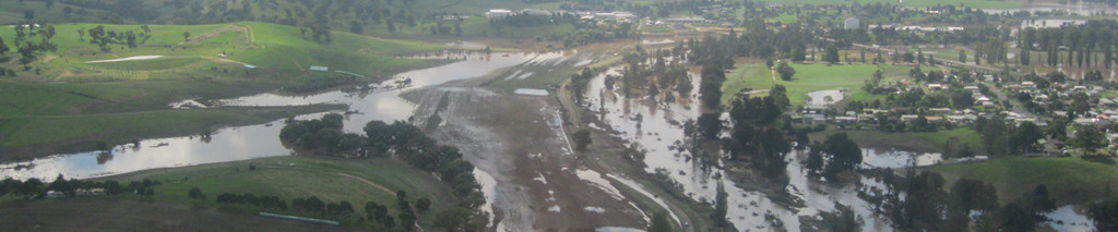
What are Floodplains?
Floodplains are the commercial, social and environmental arteries of the State. Transport and communication infrastructure are often located in floodplains and are a base for a significant proportion of the State’s agricultural business. Regular flooding enhances agricultural productivity by increasing soil moisture, recharging groundwater and depositing fertile silt across the floodplain. However, flooding can also interfere with production, communication, transport, emergency management and agricultural practices. Therefore development and management of floodplains needs to consider a broad range of issues including balancing the benefits of occupying the floodplain against the costs.
Related information
© Bega Valley Shire Council 2025
Our council websites
Contact Us
- 02 6499 2222
- council@begavalley.nsw.gov.au
-
Zingel Place
PO Box 492
Bega NSW 2550 -
Monday to Friday 9.00AM to 4.30PM
Administration building Zingel Place Bega
Australia -
ABN: 26 987 935 332