Bega Valley Local Environmental Plan 2013
The environmental planning instrument which allows Council to manage the way in which land may be used and developed in the Bega Valley Shire.
What is the Local Environmental Plan?
The Local Environmental Plan is the principal legal document for controlling development at the council level. The zoning provisions establish permissibility of uses and standards regulate the extent of development. They are prepared by councils and approved by the Minister for Planning and Environment after public exhibition.
To assist in the interpretation of the Bega Valley Local Environmental Plan 2013 (Bega Valley LEP), Council has prepared a Land Use Matrix. This was last updated on February 2024. The Matrix shows the permissible and prohibited land uses in each zone used in the Bega Valley LEP. The matrix can be viewed as an excel spreadsheet or as a table. Download the Matrix or Download the Table
Changes to the provisions or maps in a Local Environmental Plan can be made in some instances following the preparation of a planning proposal. For information about the planning proposal process please refer to the Local Environmental Plan Making Guideline.
A range of changes to Bega Valley Local Environmental Plan 2013 came into effect on 5 July 2024 as Bega Valley Local Environmental Plan 2013 Amendment 43 (Housing Diversity Planning Proposal)
To find out how that change affects planning controls in certain areas please refer to this document.
Employment zones commence within Bega Valley Local Environmental Plan 2013 on 26 April 2023. From 26 April 2023, in a document* (other than a state environmental planning policy) a reference to a former zone under an environmental planning instrument is taken to include a reference to a new zone under the environmental planning instrument.
To determine the new zone for previously zoned Business and Industrial zoned land please refer to the equivalent zones here.
Note: Document means an Act, statutory or other instrument, contract or agreement, and includes a document issued or made under or for the purposes of an Act or statutory or other instrument.
* Document means an Act, statutory or other instrument, contract or agreement, and includes a document issued or made under or for the purposes of an Act or statutory or other instrument.
As of 1 December 2021, a reference to an Environment Protection zone E1, E2, E3 or E4 in a document should be taken to be a reference to a Conservation zone C1, C2, C3 or C4. For further information please see Standard Instrument (Local Environmental Plans) Amendment (Land Use Zones) Order 2021.
Local Environmental Plan 2013
NSW Department of Planning and Environment’s planning reforms required all councils in NSW to develop a standardised local environmental plan (LEP). Bega Valley Shire Council’s new LEP was gazetted on 2 August 2013 (known as Bega Valley Local Environmental Plan 2013 or BVLEP 2013) and this largely replaces the Bega Valley Local Environmental Plan 2002.
Bega Valley Local Environmental Plan 2013 rezones the majority of the land in the Shire and sets out new permitted and prohibited uses in the zones. It carries over some provisions from Bega Valley Local Environmental Plan 2002 and also establishes a number of new planning requirements and considerations.
A number of properties are deferred from Bega Valley Local Environmental Plan 2013 and so Bega Valley Local Environmental Plan 2002 will continue to apply to these properties until planning proposals are approved by the Department of Planning and Environment.
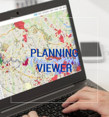
To assist with the identification of the relevant zoning and other information that is applicable to a parcel of land, the Department of Planning and Environment have developed Planning Viewer under EPlanning. The Planning Viewer is a free online tool that shows the planning rules that apply for properties across NSW.
 How it works - Users can do a basic text-based search by either typing an address or place, or an interactive search directly on the map. You can also use land titles information to do an advanced search. Once a property is found, the user can view a summary of the relevant planning rules or select different map layers. The “Proximity” feature lets users search for map layers that apply to properties near the specified address. Users can also explore multiple map layers simultaneously.
The Planning Viewer provides links to Environmental Planning Instruments – including Local Environmental Plans or State planning policies - on the Legislation website.
Bega Valley Local Environmental Plan 2013 includes maps about zoning, lot size, height of buildings, floor space ratio, land acquisitions, heritage items & conservation areas, additional permitted uses & local clauses, biodiversity, water & wetlands, natural resources and acid sulfate soils.
The Bega Valley Local Environment Plan 2013 and associated map can be found on the NSW Legislation website using the following links:


