- Home
-
Services

Services
Information about Council's regular services and programs.
-
Community

Community
Information about Council's community initiatives and support.
-
Business

Business
Information about doing business and investing in the shire.
-
Development

Development
Information about Building and Development in the Bega Valley Shire.
-
Council

Council
Information about how Council operates.
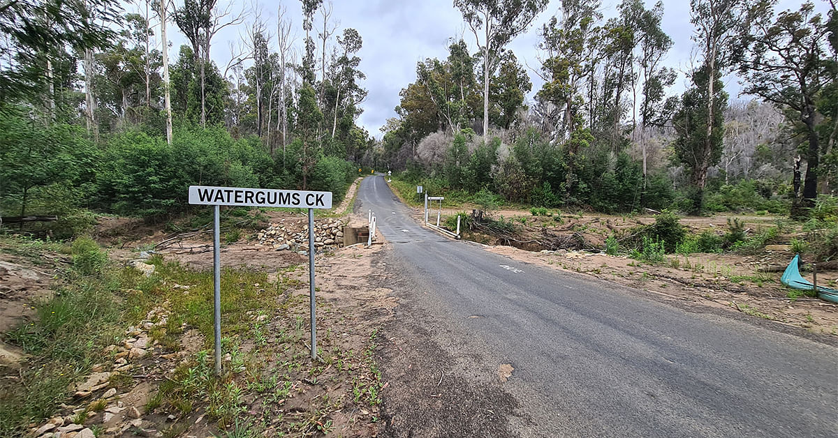
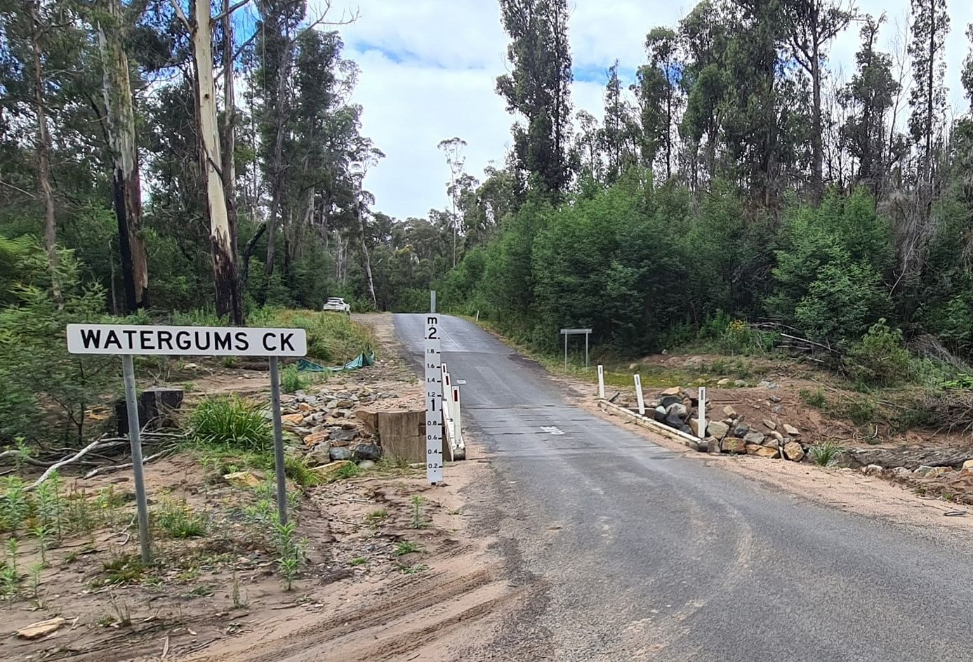
Watergums Creek Bridge Upgrade
The Watergums Creek Bridge upgrade will improve access and resilience for the Wonboyn community.
Project Summary/background
The Watergums Creek Bridge upgrade will improve access and resilience for the Wonboyn community and all traffic passing over the bridge.
The new bridge design considers the flood conditions of the Wonboyn River and Watergums Creek, and the existing level of service of Wonboyn Road in order to maintain access for road users between Wonboyn and the Princes Highway during flood events.
The recent, prolonged rainfall experienced in the Bega Valley resulted in Watergums Creek Bridge being inundated on 8 separate occasions from July 2020 to April 2022, resulting in closure of Wonboyn Road for total duration of 20 days. On four of these occasions, the bridge was inundated by more than two metres.
The new bridge will:
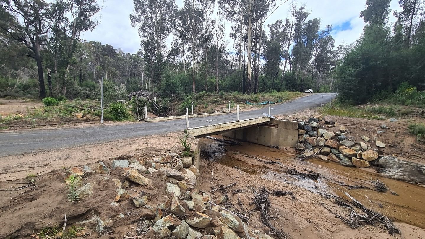
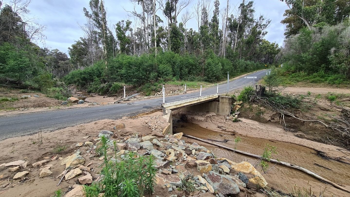
- replace the existing timber bridge with a reinforced concrete structure, resilient to bushfire threats and designed to withstand greater flood forces and debris loading.
- have a deck 3m higher than the existing bridge and we will be completing the required earthworks for the new approaches.
- include a deck above the estimated 1% annual flood event (100-year flood event). The existing bridge is currently below the 20% AEP flood height.
- have a greater resilience to natural disasters. The road will not be flood immune as it is still affected in several locations due to the natural topography and road alignment.
Purpose
The main purpose of this project is to:
- improve access, including emergency access, to Wonboyn.
- improve infrastructure resilience during natural disasters.
- reduce the maintenance burden to Council.
The design
The design of the new bridge will:
- be a two lane, two span, 30 metre reinforced concrete structure.
- have a design life of 100 years.
- be designed and constructed to SM1600 loading, which accounts for the possibility of two multi-trailer trucks travelling in convey, in a traffic lane. The proposed bridge design includes two lanes - an improvement from the existing single-lane bridge.
- be an ‘InQuik’ bridging system, which will aid in the program and quality of the works.
Construction
Construction will involve:
- early works to build the by-track and clear the debris in the river will commence in the coming months as outlined in the timeline.
- bridge construction works commencing in July and continuing through to November this year pending weather and other preliminary activities.
- maintained access to Wonboyn via the bypass track and a single lane, temporary bailey-bridge operating under traffic lights for the duration of works. This will be a similar arrangement to the works that were completed on the Wonboyn river bridge.
- access to Wonboyn via the current bridge or temporary bridge at all times exceptt for small pre-planned closures or emergencies.
Environmental controls
Enviornmental controls will applied through:
- the removal of some of the debris in the creek downstream of the bridge as the piles are an environmental and design risk.
- erosion and Sediment controls will also be included as normal practise for this project to control the risk of material entering the waterway.
- the clearing of some areas of the river banks for construction activities and the by-pass track. These areas will be rehabilitated at the end of the project.
- ongoing monitoring and testing will be part of the project and through its duration as Acid sulphate soils have been identified in the project area during the geotechnical investigations. The ‘Acid Sulphate management plan’ developed outlines the controls required for the works. There is reduced risk as there will be considerable amount of clean material imported to site to raise the road hence not excavating and disturbing the ground.
- testing of water has also been suggested by the Geotechnical consultant and involves a collection of tests for different scenarios as per the management plan.
Funding
This project is funded by the Australian Government with a contribution by Bega Valley Shire Council.
The Australian Government has funded $3.54M of this project under the Bridges Renewal Program.
Bega Valley Shire Council is contributing $1M to this project, from funds contributed by the NSW Government following the declared natural disaster of severe weather and flooding in February and March 2022 (AGRN 1012).
Connection to Council's Community Strategic Plan
This project aligns with Bega Valley Shire Council Community Strategic Plan through:
- A.7 – Provide and support ongoing emergency response and recovery efforts to rebuild communities and support resilience capacity building.
- C.5 – Lead climate change mitigation and adaption through implementation of our Climate Resilience Strategy focusing on natural systems, preparing for natural hazards, livable and connected places, safe, healthy and inclusive community, diverse and thriving economy, energy security and food security.
- D.1 – Plan for community infrastructure and services that will meet current and future needs.
- D.2 – Provide infrastructure and services to meet the needs of residents in our towns, villages and rural areas.
Related documents
Who to talk to
Cheyne Dick-Lenehan
A/Technical Services Coordinator
Bega Valley Shire Council
Phone: (02) 6499 2222
Email: CDick-Lenehan@begavalley.nsw.gov.au
Timeline of works
Council intends to complete construction during 2025. The proposed timeframe is:
-
January to March 2023
Project Planning, Environmental Reports and Detailed Design.
-
April 2024 to July 2024
Undertake Procurement Activities for Construction.
-
Mid - 2024
Construction Planning Activities.
-
October 2024 to December 2024
Proposed Construction Period.
-
December 2024
The project is now complete with the bridge opening to traffic just before the Christmas school holidays.
Frequently Asked Questions
Wonboyn River Bridge was replaced under the NSW Governments Fixing Country Bridges Program, which was a program dedicated for replacing aging timber bridges which are near the end of their practical lives. The program did not financially allow for infrastructure upgrades to meet recent flood levels.
Due to the length of the Wonboyn River Floodplain in this location, to raise the bridge an additional 1.0m, approximately 400m of roadworks would be required to raise the road approaches to the same level. This extent of works was not feasible based on the funding and scope of works approved under the Fixing Country Bridges Grant.
No, Wonboyn Road is flood affected in several locations due to the natural topography and road alignment.
Wonboyn Road will still be susceptible to flooding where it crosses the floodplain at Wonboyn River Bridge, and where Wonboyn Road runs adjacent to the Wonboyn River between Watergums Creek Bridge and the Wonboyn Village.
Currently Watergums Creek Bridge is the location where Wonboyn Road provides the lowest level of flood immunity.
Whilst Wonboyn Road will remain flood affected, the frequency and duration of road closures on Wonboyn Road will be reduced because of this upgrade.
The upgraded bridge will be on the existing road alignment of Wonboyn Road. Access to Wonboyn will be maintained via a bypass track and a single lane, temporary bailey-bridge which will operate under traffic lights for the duration of works.
The underside of the bridge has been designed to be 500mm above the estimated 5% annual flood event (historically referred to as the 20-year flood event). This results in the bridge deck being above the estimated 1% annual flood event (historically referred to as the 100-year flood event).
The upgraded bridge will be a reinforced concrete structure, resilient to bushfire threats and designed to withstand loading of flood forces and debris, with a design life of 100 years. The bridge will be designed and constructed to SM1600 loading, which accounts for the possibility of two multi-trailer trucks travelling in convey, in a traffic lane. The proposed bridge design includes two lanes - an improvement from the existing single-lane bridge.
Yes. We will ensure that there is clear, safe access to the water fill point located north of the bridge throughout the duration of the project.
For typical construction contracts the defects period is 12 months after works is complete. This has not yet been confirmed and will depend on the contracts for this project. Note that natural disasters such as flooding are not construction defects and are managed via a different process differently. Any defects that arise after the contractor liability period will be addressed by Council as the asset owner.
As part of the ‘Fisheries Management Act 1994 (FM Act)’ it is a requirement to submit a permit for any ‘Dredging, reclamation or barrier to fish passage in the waterway’. Council has been in consolation with Fisheries for this project to ensure that all items on concern are addressed and the project is managed in a safe and responsible manner as per the environmental legislation.
Our current estimates are 4-6 weeks for the removal of the debris which will include building a safe access to the stockpile. We are awaiting feedback from the contractor who will be completing the works.
There will be several procedures employed to monitor, manage and protect the bridge during construction works. Unfortunately the bridge will be vulnerable until construction is completed and the necessary protection is completed but this will be assessed to determine what other controls can be included.
Image Galleryhere
News and Updates
© Bega Valley Shire Council 2025
Our council websites
Contact Us
- 02 6499 2222
- council@begavalley.nsw.gov.au
-
Zingel Place
PO Box 492
Bega NSW 2550 -
Monday to Friday 9.00AM to 4.30PM
Administration building Zingel Place Bega
Australia -
ABN: 26 987 935 332